


le Rozier,Hyelzas

alinetpierre
User

Length
19.1 km

Max alt
971 m

Uphill gradient
1043 m
Km-Effort
31 km

Min alt
439 m

Downhill gradient
527 m
Boucle
No
Creation date :
2022-06-21 05:59:42.343
Updated on :
2022-06-21 14:31:46.535
5h49
Difficulty : Medium

FREE GPS app for hiking
 SityTrail
IGN / Geographical institutes
SityTrail Plus
The world is yours!
About
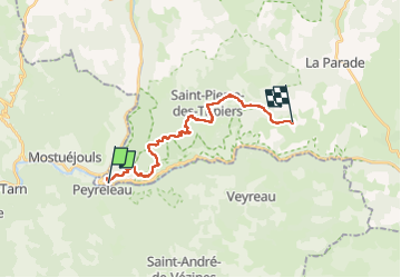
Trail Walking of 19.1 km to be discovered at Occitania, Lozère, Le Rozier. This trail is proposed by alinetpierre.
Description
Par les corniches du vertige.
Positioning
Country:
France
Region :
Occitania
Department/Province :
Lozère
Municipality :
Le Rozier
Location:
Unknown
Start:(Dec)
Start:(UTM)
516930 ; 4893093 (31T) N.
Comments